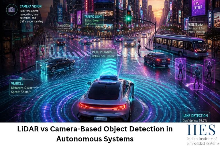
2. What Is LiDAR Object Detection?
LiDAR stands for Light Detection and Ranging. It is a sensing technology that uses laser pulses to measure the distance between a sensor and objects in its surroundings.
A LiDAR sensor emits laser pulses and measures the time taken for the reflected light to return to the sensor. This process is called Time of Flight (ToF).
Using the measured time and the speed of light, the system calculates the distance to an object.
The distance calculation is based on:
Distance = (Speed of Light × Time of Flight) / 2
The division by two accounts for the laser pulse travelling to the object and returning to the sensor.
How LiDAR Works in Autonomous Vehicles
A LiDAR-based object detection system generally follows these steps:
- Laser emission: The LiDAR sensor transmits laser pulses into the surrounding environment.
- Light reflection: The pulses hit objects such as vehicles, pedestrians, buildings, and road surfaces.
- Signal reception: The sensor detects reflected laser pulses.
- Distance calculation: The system calculates the distance using the time-of-flight measurement.
- Point cloud generation: Multiple distance measurements are combined to create a 3D representation of the environment.
- Object detection: Deep learning or geometric algorithms process the point cloud to identify and classify objects.
- Environmental perception: The autonomous system uses the detected objects and their positions for navigation and decision-making.
What Is LiDAR Point Cloud Processing?
A point cloud is a collection of three-dimensional data points representing objects and surfaces in the environment.
Each point generally contains X, Y, and Z coordinates. Depending on the sensor, additional information such as intensity and timestamps may also be available.
For example, a LiDAR sensor mounted on an autonomous vehicle can generate thousands or millions of points representing nearby vehicles, pedestrians, buildings, and road surfaces.
Common LiDAR point cloud processing techniques include:
- Voxelization
- Ground plane segmentation
- Clustering
- Noise filtering
- Point cloud registration
- 3D bounding box detection
Deep learning architectures such as PointPillars, PointNet++, and VoxelNet are used for 3D object detection from LiDAR data.
These techniques help autonomous systems estimate the position, dimensions, and orientation of surrounding objects.
3. What Is Camera-Based Object Detection?
Camera-based object detection uses digital cameras to capture images or video of the surrounding environment. Computer vision algorithms process these images to identify and classify different objects.
Unlike LiDAR, which directly measures distance using laser pulses, a conventional camera captures two-dimensional visual information.
Camera-based object detection is widely used in autonomous vehicles, surveillance systems, robotics, driver assistance systems, and industrial inspection.
How Camera-Based Object Detection Works
A camera-based object detection system generally follows these steps:
- Image acquisition: A camera captures images or video frames of the surrounding environment.
- Image preprocessing: The captured images are resized, normalized, and prepared for model inference.
- Feature extraction: A deep learning model identifies important visual features such as edges, shapes, textures, and patterns.
- Object classification: The model identifies objects such as pedestrians, vehicles, bicycles, and traffic signs.
- Bounding box generation: The system identifies the approximate location of detected objects using bounding boxes.
- Confidence estimation: The model assigns confidence scores to its predictions.
- Decision-making: The autonomous system uses the detected information for navigation, obstacle avoidance, and vehicle control.
Popular Object Detection Algorithms
Several computer vision algorithms are used in camera-based object detection.
1. YOLO (You Only Look Once)
YOLO is a real-time object detection algorithm that predicts object locations and classes in a single network evaluation. It is useful for applications that require fast detection, such as autonomous driving and robotics.
2. SSD (Single Shot MultiBox Detector)
SSD detects objects at multiple feature map scales. It provides a balance between detection speed and accuracy and can be used in real-time vision applications.
3. Faster R-CNN
Faster R-CNN is a two-stage object detection architecture. It first identifies possible object regions and then classifies them. It can provide strong detection accuracy but may require more computational resources than lightweight real-time models.
4. MobileNet-SSD
MobileNet-SSD combines a lightweight feature extraction network with SSD detection. It is suitable for resource-constrained embedded AI devices and edge computing applications.

4. LiDAR vs Camera-Based Object Detection: Key Differences
LiDAR and cameras perform different roles in autonomous vehicle perception. LiDAR primarily provides geometric and depth information, while cameras provide detailed visual information.
The following comparison explains their major differences.
| Comparison Factor | LiDAR | Camera |
| Working principle | Laser-based distance measurement | Image capture and computer vision |
| Data output | 3D point cloud | 2D images or video |
| Depth information | Directly measures distance | Estimated through visual techniques |
| Object detection | 3D geometric detection | Image-based detection |
| Color information | Generally unavailable | Rich color information |
| Distance measurement | Direct distance measurement | Requires depth estimation or additional sensors |
| Low-light performance | Generally strong with active illumination | Depends on camera and lighting |
| Bright sunlight | Can experience interference | Can experience glare and exposure problems |
| Weather performance | Rain, fog, and snow can affect measurements | Rain, fog, and snow can reduce visibility |
| Hardware cost | Generally higher | Generally lower |
| Processing requirements | Point cloud processing can be computationally demanding | Deep learning inference can be demanding |
| Common applications | 3D mapping, obstacle detection, autonomous navigation | Object classification, traffic sign recognition, lane detection |
Neither technology is universally superior. The right choice depends on the application’s safety requirements, operating environment, budget, and computational resources.
5. Advantages of LiDAR in Autonomous Driving
LiDAR provides important benefits for autonomous vehicle perception.
5.1 Accurate Distance Measurement
One of the major advantages of LiDAR is its ability to directly measure the distance between the sensor and surrounding objects.
This helps autonomous vehicles estimate the positions of nearby pedestrians, vehicles, and obstacles.
5.2 3D Environmental Mapping
LiDAR generates three-dimensional point clouds that represent the surrounding environment.
This information is useful for:
- 3D mapping
- Obstacle detection
- Autonomous navigation
- Localization
- Path planning
5.3 Better Performance in Low-Light Conditions
Since LiDAR uses its own laser illumination, it does not depend on visible ambient light in the same way as conventional cameras.
It can therefore operate effectively in many low-light conditions, although performance still depends on sensor specifications and environmental conditions.
5.4 Object Distance and Position Estimation
LiDAR provides geometric information that helps estimate the distance, position, and dimensions of surrounding objects.
This is particularly useful for collision avoidance and autonomous navigation.
5.5 Useful for Complex Environments
LiDAR is widely used in robotics and autonomous driving applications where accurate spatial information is important.
However, LiDAR is not immune to environmental interference. Heavy rain, fog, snow, reflective surfaces, and other atmospheric conditions can affect measurement quality.
6. Limitations of LiDAR Object Detection
Despite its advantages, LiDAR has several limitations.
- Higher Hardware Cost: High-performance automotive LiDAR sensors can be more expensive than conventional camera systems.
- Limited Visual Information: LiDAR generally does not provide the same color and texture information as cameras. It may struggle to distinguish objects that have similar geometric shapes.
- Point Cloud Processing Complexity: Processing large point clouds requires memory, computational resources, and specialized algorithms.
- Environmental Interference: Rain, fog, snow, and dust can scatter or absorb laser signals, affecting detection performance.
- Sensor Integration Challenges: LiDAR systems require calibration, synchronization, and integration with other vehicle sensors.
These limitations explain why autonomous vehicle developers often combine LiDAR with cameras rather than depending on LiDAR alone.
7. Advantages of Camera-Based Object Detection
Camera-based object detection is an important technology in autonomous systems because it provides detailed visual information at a relatively low hardware cost.
7.1 Rich Visual Information
Cameras capture color, texture, shape, and visual patterns.
This information helps autonomous vehicles recognize:
- Traffic signs
- Traffic lights
- Road markings
- Pedestrians
- Vehicles
- Lane boundaries
7.2 Lower Hardware Cost
Compared with many automotive LiDAR systems, conventional cameras are relatively affordable.
This makes camera-based object detection suitable for large-scale applications and cost-sensitive autonomous systems.
7.3 Advanced Deep Learning Support
Modern computer vision frameworks support several object detection models.
YOLO, SSD, Faster R-CNN, and other neural network architectures can identify and classify multiple objects from images.
7.4 Traffic Sign and Signal Recognition
Cameras are particularly useful for recognizing visual information such as traffic signals, road signs, and lane markings.
This makes them important components of Advanced Driver Assistance Systems (ADAS).
7.5 Embedded AI Deployment
Lightweight computer vision models can run on embedded AI platforms such as NVIDIA Jetson and other AI-enabled edge devices.
With model optimization techniques such as quantization and pruning, developers can reduce computational requirements and improve inference efficiency.
8. Limitations of Camera-Based Object Detection
Camera-based systems also face several technical challenges.
- Lighting Dependency: Poor lighting, darkness, direct sunlight, and glare can affect image quality and object detection accuracy.
- Difficult Depth Estimation: A conventional monocular camera captures 2D images and does not directly measure the distance to an object. Depth can be estimated using techniques such as stereo vision, monocular depth estimation, and structure from motion.
- Weather Sensitivity: Fog, rain, snow, and dirty camera lenses can reduce image visibility.
- Occlusion: When an object is partially hidden behind another object, the detection model may fail to recognize it correctly.
- Computational Requirements: Deep learning models require sufficient processing power, memory, and optimized inference pipelines, particularly for real-time applications.
9. LiDAR vs Camera: Which Is Better for Autonomous Driving?
There is no single answer to whether LiDAR or camera-based object detection is better.
Both technologies have different strengths and are suitable for different perception tasks.
| Application | Preferred Technology | Reason |
| Accurate distance measurement | LiDAR | Direct distance measurement |
| Traffic sign recognition | Camera | Visual information and color |
| 3D environmental mapping | LiDAR | 3D point cloud generation |
| Lane detection | Camera | Road markings and visual features |
| Low-light obstacle detection | LiDAR | Active laser illumination |
| Object classification | Camera | Detailed image information |
| 3D obstacle localization | LiDAR | Geometric depth information |
| Cost-sensitive vision systems | Camera | Lower hardware cost |
For applications requiring accurate spatial information, LiDAR provides significant advantages.
For applications involving visual classification, traffic signal recognition, and lane detection, cameras are highly useful.
Modern autonomous driving systems increasingly use multiple sensing technologies to overcome the limitations of individual sensors.

10. Sensor Fusion in Autonomous Vehicles: Combining LiDAR and Cameras
Sensor fusion in autonomous vehicles refers to combining information from multiple sensors to create a more complete understanding of the surrounding environment.
LiDAR and cameras provide complementary information.
- LiDAR provides accurate distance and 3D spatial information.
- Cameras provide color, texture, and visual classification information.
By combining these data sources, autonomous systems can improve object detection and environmental perception.
How LiDAR and Camera Sensor Fusion Works
A typical sensor fusion pipeline includes the following stages:
1. Sensor Data Acquisition
LiDAR sensors generate point clouds, while cameras capture image frames.
2. Sensor Calibration
The camera and LiDAR must be calibrated to establish their spatial relationship.
Extrinsic calibration determines the relative position and orientation of the sensors. Intrinsic calibration describes the internal camera parameters.
3. Time Synchronization
Sensor measurements must be aligned in time because the camera and LiDAR may capture data at different frequencies.
4. Data Alignment
The system transforms LiDAR points into the camera coordinate system using calibration parameters.
This allows 3D points to be associated with corresponding image regions.
5. Feature Extraction
Computer vision models extract image features, while point cloud processing algorithms extract geometric features.
6. Feature Fusion
The system combines the extracted information to improve object detection.
7. Object Detection and Tracking
The fused information is used to detect, classify, localize, and track surrounding objects.
Types of Sensor Fusion
- Early Fusion: Sensor data is combined at an early stage, often before the complete feature extraction process.
- Intermediate Fusion: Features extracted from different sensors are combined within the neural network.
- Late Fusion: Individual sensors or models generate predictions independently, and their results are combined at the decision level.
Each fusion strategy has different computational requirements and accuracy characteristics.
11. Real-World Applications of LiDAR and Camera-Based Object Detection
LiDAR and camera technologies are used in several industries beyond autonomous cars.
11.1 Self-Driving Cars
Autonomous vehicles use LiDAR and cameras to detect pedestrians, vehicles, road boundaries, and obstacles.
These perception systems provide important information for path planning and vehicle control.
11.2 Mobile Robotics
Autonomous mobile robots (AMRs) use LiDAR for mapping, localization, and obstacle avoidance.
Cameras help identify objects, recognize visual landmarks, and understand their surroundings.
11.3 Industrial Automation
In smart factories, camera-based object detection is used for quality inspection, product identification, and robotic picking.
LiDAR can help industrial robots measure distances and detect obstacles within their operating areas.
11.4 Smart Transportation
Intelligent transportation systems use cameras and LiDAR-based sensing to monitor traffic, detect vehicles, and analyze road conditions.
11.5 Autonomous Drones
Drones use cameras for visual navigation, object recognition, and aerial inspection.
Lightweight LiDAR sensors can support terrain mapping, altitude measurement, and obstacle detection in suitable drone platforms.
12. Embedded AI Hardware for Object Detection
Running LiDAR and camera-based object detection algorithms requires suitable computing hardware.
In autonomous systems, perception algorithms often operate on embedded processors, GPUs, and specialized AI accelerators.
Some commonly used platforms include:
NVIDIA Jetson
NVIDIA Jetson platforms are designed for edge AI and embedded computing applications.
They support computer vision, deep learning inference, robotics, and real-time object detection.
Developers can deploy optimized neural networks using frameworks such as TensorRT.
Raspberry Pi
Raspberry Pi boards are useful for learning computer vision and developing prototype object detection systems.
They can run lightweight models and interface with camera modules and external sensors.
STM32 Microcontrollers
STM32 microcontrollers are widely used in embedded applications involving sensor interfacing, motor control, and real-time processing.
Although conventional STM32 microcontrollers have limited resources for large object detection models, selected STM32 devices support TinyML and lightweight machine learning applications.
Edge AI Accelerators
Dedicated AI accelerators can improve neural network inference performance while reducing the processing load on the main processor.
The choice of hardware depends on model complexity, frame rate, power consumption, memory availability, and latency requirements.
13. Challenges in Real-Time Object Detection for Autonomous Systems
Real-time object detection is one of the most demanding tasks in autonomous systems.
The perception system must process sensor data quickly and accurately to support safe decision-making.
Some major challenges include:
- Processing Latency: Object detection algorithms must process incoming sensor data within the system’s timing requirements.
- Sensor Synchronization: Camera and LiDAR data must be aligned correctly to avoid inaccurate object associations.
- Environmental Conditions: Lighting changes, rain, fog, dust, and occlusion can affect sensor performance.
- Computational Limitations: Embedded platforms have limited processing power, memory, and energy budgets.
- Detection Reliability: False positives and false negatives can affect downstream planning and control systems.
- Sensor Calibration: Incorrect calibration can create spatial misalignment between camera images and LiDAR point clouds.
To address these challenges, developers use optimized neural networks, hardware acceleration, sensor fusion, filtering algorithms, and robust testing methods.
14. Future Trends in Autonomous Vehicle Perception
The development of autonomous systems is driving continuous improvements in sensor technology and AI-based perception.
Some important trends include:
AI-Based Sensor Fusion
Deep learning techniques are increasingly used to combine information from multiple sensors and improve environmental understanding.
3D Object Detection
Advanced neural networks are improving the ability to detect and classify objects directly from 3D point clouds.
Vision-Based Autonomous Driving
Advances in computer vision and deep learning are enabling increasingly sophisticated camera-based perception systems.
Edge AI Processing
More perception algorithms are being optimized for embedded platforms to reduce latency and dependence on cloud computing.
Multi-Sensor Perception
Future autonomous systems will continue to explore combinations of cameras, LiDAR, radar, ultrasonic sensors, and inertial measurement units (IMUs).
These technologies can provide complementary information for more robust environmental perception.
15. Conclusion
LiDAR and camera-based object detection are two important technologies in autonomous systems. LiDAR provides accurate distance measurements and 3D environmental information, while cameras deliver detailed visual information for object classification, traffic sign recognition, and lane detection.
Although each technology has limitations, combining them through sensor fusion can improve environmental perception and support more reliable autonomous navigation.
For embedded engineers and AI developers, understanding LiDAR vs Camera-Based Object Detection is valuable when designing autonomous vehicles, robotics applications, and intelligent sensing systems.
As computer vision, embedded AI, and sensor fusion technologies continue to advance, these sensing methods will play an increasingly important role in the development of intelligent autonomous systems.