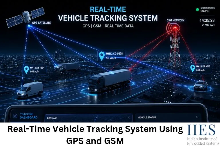
What Is a GPS and GSM Based Vehicle Tracking System?
A GPS and GSM based vehicle tracking system is an electronic monitoring solution that determines the real-time location of a vehicle and sends that information to a remote user.
The system combines two major technologies:
- GPS (Global Positioning System): Determines the vehicle’s geographical location using signals received from satellites.
- GSM (Global System for Mobile Communications): Transmits the collected location information through a cellular network.
A microcontroller processes the GPS coordinates and controls communication with the GSM module. The location can be shared through SMS or sent to an online server for display on a digital map.
For example, consider a logistics company managing 20 delivery vehicles. Instead of calling every driver to ask for their position, the company can track all vehicles remotely using a vehicle location monitoring system.
This technology is useful for fleet operators, transportation companies, emergency services, and individual vehicle owners.
How Does a Real-Time GPS Tracking System Using GSM Work?
The working principle of a GPS and GSM based vehicle tracking system involves three major operations: location detection, data processing, and wireless transmission.
The basic working process involves the following steps:
GPS Satellite Communication
When the system is powered ON, the GPS module starts receiving signals from available GPS satellites and calculates its geographical position. It generates information such as latitude, longitude, speed, altitude, date, and time.
The NEO-6M GPS module typically provides this information through serial communication in NMEA format.
Microcontroller Data Processing
The microcontroller receives the GPS information through its UART interface and extracts the required latitude and longitude values. It also checks whether the GPS receiver has obtained a valid satellite fix. Once valid coordinates are available, the controller prepares the location information for transmission.
GSM Network Communication
The processed location data is sent to the SIM800L GSM module using AT commands. Depending on the project requirements, the GSM module can send an SMS containing the vehicle’s coordinates or transmit the data to a remote server using GPRS.
Location Monitoring
The receiver can view the location through a mobile phone or an online monitoring platform. The coordinates can be converted into a map location using a mapping service. For example, a location link can be generated in the following format:
https://www.google.com/maps?q=12.9716,77.5946
When the user opens the link, the corresponding location is displayed on the map.
Continuous Vehicle Tracking
The system repeats the process at predefined intervals, such as every 30 seconds or every minute, depending on the application. The update frequency depends on GPS performance, network availability, power consumption, and server requirements.

Role of Embedded Systems in GPS and GSM Vehicle Tracking
Embedded systems in vehicle tracking are responsible for coordinating the GPS receiver, the GSM module, and the power supply so that location data reaches the user reliably.
Let’s understand the major roles of embedded technology in a tracking system.
Microcontroller-Based Control
The microcontroller acts as the central processing unit of the tracking system. It receives coordinates from the GPS module, processes the data, and communicates with the GSM module.
Popular microcontroller options include:
- Arduino Uno
- Arduino Mega
- ESP32
- ATmega328P
For beginners, Arduino Uno is a convenient option because of its simple programming environment and UART communication support.
GPS Data Processing
The NEO-6M GPS module is commonly used in embedded projects to determine geographical positions. It receives signals from GPS satellites and provides latitude, longitude, altitude, speed, and time.
Important features include:
- Satellite-based positioning
- Latitude and longitude information
- Serial data output over UART
- Support for the NMEA GPS data format
- Low-power operation
The module provides updated location coordinates only when a valid satellite fix is available, so the embedded software must validate the data before using it.
GSM Communication Using AT Commands
The SIM800L GSM module enables wireless communication between the tracking hardware and a remote monitoring device. It uses a SIM card to connect to a mobile network and is controlled by the microcontroller through AT commands.
Its major functions include:
- Sending SMS messages
- Making and receiving calls
- Communicating with remote servers using supported cellular data services
- Transmitting GPS coordinates through the cellular network
Important: SIM800L supports 2G GSM/GPRS connectivity only. Its practical use depends on the availability of compatible 2G networks and operator support in the deployment area.
Power Supply Management
The power supply provides the required operating voltage to the microcontroller, GPS module, and GSM module. A vehicle battery can serve as the primary source, but voltage regulation and suitable DC-DC converters are necessary to provide stable power to each component.
The SIM800L requires particular attention because it can draw current peaks of approximately 2 A during cellular transmission. It should never be powered directly from an Arduino 5V output.
UART Serial Communication
Both the GPS and GSM modules communicate with the microcontroller through UART. The microcontroller acts as a bridge between them: the GPS module supplies geographical information, while the GSM module transfers that information to the remote user.
| Parameter | GPS Module | GSM Module |
| Main function | Location detection | Wireless communication |
| Communication | Satellite signals | Cellular network |
| Interface | UART | UART |
| Output | Latitude and longitude | SMS and network responses |
| Example module | NEO-6M | SIM800L |
This combination makes it possible to develop a low-cost vehicle tracking system using a microcontroller.
Major Components of a Vehicle Tracking System
A GPS and GSM based vehicle tracking system consists of several hardware and software components that work together.
| Component | Function |
| Microcontroller | Processes GPS data and controls the GSM module |
| NEO-6M GPS Module | Provides latitude, longitude, speed, and time |
| SIM800L GSM Module | Sends location through SMS or GPRS |
| Power Supply | Provides regulated voltage to all modules |
| GPS and GSM Antennas | Receive satellite signals and connect to the cellular network |
| SIM Card | Provides network access with an active cellular plan |
| Voltage Regulator | Provides stable power to individual modules |
| Embedded Software | Manages GPS reading, validation, and GSM communication |
The combination of these components makes the vehicle tracker an important application of embedded systems.
Vehicle Tracking System Circuit Diagram and Connections
The circuit connections explain how the different hardware components communicate with the microcontroller. For an Arduino-based implementation, the connections can be organized as follows.
| Component | Arduino Connection | Function |
| NEO-6M GPS TX | Digital RX pin | Sends GPS data |
| NEO-6M GPS RX | Digital TX pin | Receives configuration data |
| SIM800L TX | Arduino RX pin | Sends GSM response |
| SIM800L RX | Arduino TX pin | Receives AT commands |
| GPS VCC | Compatible regulated supply | Powers GPS |
| SIM800L VCC | Regulated supply as specified | Powers GSM |
| GND | Common ground | Reference connection |
The UART connections should be arranged according to the selected hardware serial ports or software serial configuration.
Important circuit considerations:
- Check the operating voltage of every module before connecting it.
- Use appropriate logic-level conversion where required.
- Provide a stable power supply for the SIM800L that can support current peaks of approximately 2 A.
- Connect the GPS and GSM antennas correctly.
- Ensure that all components share a common ground.

GPS Tracking System Using Arduino: Programming and Implementation
Arduino can be used to develop a basic GPS tracking system because it supports serial communication and can interface with both GPS and GSM modules. The programming logic involves reading GPS coordinates, checking their validity, and transmitting the information through the GSM module.
Initialize the Modules
Configure the serial communication interfaces for the GPS and GSM modules.
Read GPS Information
Continuously receive GPS data and extract the latitude and longitude values.
Validate GPS Coordinates
Check whether the GPS module has obtained a valid location fix.
Prepare Location Data
Convert the extracted coordinates into a readable format or a Google Maps URL.
Send Location Information
Use GSM AT commands to send the location through SMS or transmit it to a remote server.
A simplified programming workflow looks like this:
#include
#include <TinyGPS++.h>

SoftwareSerial gpsSerial(4, 3);
SoftwareSerial gsmSerial(7, 8);

TinyGPSPlus gps;

void setup() {
  Serial.begin(9600);
  gpsSerial.begin(9600);
  gsmSerial.begin(9600);
}

void loop() {

  gpsSerial.listen();

  while (gpsSerial.available()) {
    gps.encode(gpsSerial.read());
  }

  if (gps.location.isUpdated() &&
      gps.location.isValid()) {

    double latitude = gps.location.lat();
    double longitude = gps.location.lng();

    String message =
      "https://www.google.com/maps?q=" +
      String(latitude, 6) + "," +
      String(longitude, 6);

    gsmSerial.listen();

    gsmSerial.println("AT+CMGF=1");
    delay(500);

    gsmSerial.println("AT+CMGS=\"+91XXXXXXXXXX\"");
    delay(500);

    gsmSerial.print(message);
    gsmSerial.write(26);

    delay(5000);
  }
}
This is a simplified demonstration of the programming logic. A production implementation should also handle GSM registration, GPS timeouts, SMS delivery responses, serial-buffer management, and retry conditions. For reliable operation, a microcontroller with multiple hardware UART interfaces is preferable. Writing this kind of firmware requires a good foundation in embedded C.
Applications of a GPS Vehicle Tracking System
GPS vehicle tracking technology is used in several industries where vehicle location, movement, and operational monitoring are important.
| Application | How Tracking Helps |
| Fleet Management | Monitors multiple vehicles, manages delivery routes, and improves fleet utilization |
| Vehicle Theft Prevention | Sends location updates if a vehicle moves unexpectedly |
| School Bus Tracking | Shows parents bus locations and estimated arrival times |
| Emergency Vehicle Monitoring | Improves dispatch coordination for ambulances, fire trucks, and response vehicles |
| Logistics and Supply Chain | Tracks delivery progress and coordinates warehouses and distribution centers |
| Personal Vehicle Monitoring | Lets owners monitor cars, bikes, and other vehicles remotely |
Advantages of an IoT Based Vehicle Tracking System
An IoT based vehicle tracking system extends basic GPS tracking by connecting vehicle hardware to internet-based platforms. Instead of receiving only SMS notifications, users can monitor vehicles through dashboards, mobile applications, and cloud-based services.
Real-Time Location Monitoring
Provides regular vehicle location updates through connected platforms.
Remote Accessibility
Allows users to monitor vehicles from different geographical locations.
Improved Fleet Management
Helps businesses monitor vehicle movement and transportation activities.
Data Storage
Stores historical vehicle location information for future analysis.
Route Monitoring
Helps identify vehicle routes and movement patterns.
Operational Efficiency
Supports better transportation planning and resource utilization.
Modern systems can also integrate additional sensors to monitor fuel levels, engine temperature, vehicle speed, and other operational parameters, which is an important area of automotive embedded systems.
Challenges in Developing a GPS and GSM Based Vehicle Tracking System
Although GPS and GSM technologies provide an effective tracking solution, developers must consider several technical challenges.
| Challenge | Description |
| GPS Signal Availability | Buildings, tunnels, underground parking, and dense urban areas can affect satellite signal reception |
| GSM Network Coverage | Poor coverage can delay or interrupt location transmission |
| Power Consumption | GSM modules draw high current during transmission; an unsuitable supply can cause resets or failures |
| Data Transmission Delays | Network congestion and weak signals can delay delivery of location information |
| Hardware Compatibility | Modules use different voltage levels and current requirements; incorrect interfacing can damage components |
| Network Technology Limitations | SIM800L depends on 2G networks, so local network availability must be verified before selecting hardware |
Future Scope of Vehicle Tracking Technology
Vehicle tracking systems are evolving with advancements in embedded systems, IoT, artificial intelligence, and wireless communication.
- 4G and 5G Connectivity: Replacing older GSM communication modules with modern cellular technologies.
- Cloud-Based Monitoring: Storing vehicle information on cloud platforms for remote access and analysis.
- AI-Based Route Optimization: Analyzing traffic and movement data to identify efficient routes.
- Geofencing: Generating alerts when vehicles enter or leave predefined geographical boundaries.
- Fuel Monitoring: Integrating fuel sensors to monitor consumption and identify unusual usage.
- Predictive Maintenance: Using vehicle sensor data to identify potential equipment failures.
- Advanced Fleet Analytics: Analyzing historical data to improve transportation operations.
These developments show how embedded systems are becoming an important part of intelligent transportation infrastructure.
Practical Example: How the Tracker Sends a Vehicle’s Location
Consider a delivery vehicle fitted with the tracking unit, configured to send an update every minute.
The following process takes place:
- The tracker is powered ON from the vehicle battery through a regulated supply.
- The NEO-6M GPS module receives satellite signals and outputs NMEA data.
- The microcontroller reads the data through UART and extracts latitude and longitude.
- The controller checks that a valid satellite fix is available.
- The coordinates are converted into a Google Maps link.
- The microcontroller sends AT commands to the SIM800L module.
- The GSM module sends the link as an SMS to the owner’s mobile phone.
- The owner opens the link and sees the vehicle’s position on the map.
This process repeats at the set interval and requires reliable embedded control.
For engineering students, this example demonstrates how microcontrollers, GPS and GSM modules, UART communication, AT commands, and embedded C programming work together in a practical application.
Skills Required to Develop Vehicle Tracking Systems
Developing a GPS and GSM based tracking system requires knowledge of both hardware and software.
Some important technical skills include:
- Embedded C programming
- Microcontroller architecture
- UART serial communication
- GPS NMEA data parsing
- GSM AT commands
- Power supply and voltage regulation design
- Sensor and module interfacing
- IoT and cloud connectivity
- PCB design and hardware debugging
- Real-time operating systems (RTOS)
These skills are useful for engineers interested in IoT development, embedded firmware, automotive electronics, and telematics.
Career Opportunities in Vehicle Tracking and Embedded Systems
The growing use of connected vehicles and fleet telematics is creating opportunities for engineers with embedded systems and IoT knowledge.
Some relevant job roles include:
| Job Role | Major Responsibilities |
| Embedded Software Engineer | Develops embedded software for tracking and telematics devices |
| IoT Engineer | Connects devices to cloud platforms and monitoring dashboards |
| Firmware Engineer | Develops low-level microcontroller firmware |
| Telematics Engineer | Works on vehicle tracking, connectivity, and fleet systems |
| Automotive Embedded Engineer | Works on vehicle electronic systems |
| Hardware Test Engineer | Performs validation and functional testing of electronic devices |
Knowledge of embedded C, microcontrollers, UART communication, and wireless modules can help engineering graduates prepare for these technical roles.
Conclusion
A GPS and GSM based vehicle tracking system is an excellent example of how embedded technology brings together satellite navigation and wireless communication.
By combining a NEO-6M GPS module, a SIM800L GSM module, and an Arduino-based controller, developers can build a basic system that identifies vehicle coordinates and transmits them to remote users.
The project also provides practical exposure to UART communication, GPS data processing, AT commands, hardware interfacing, and embedded C/C++ programming. Beyond academic projects, the same concepts are used in fleet management, logistics, vehicle security, and intelligent transportation systems.
For electronics and engineering graduates, building this project is a valuable way to understand how embedded systems are used in real-world applications.
Learning these technologies through practical projects and hands-on training can help students build the technical foundation required for careers in embedded systems and IoT.